


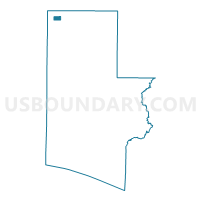
FLOWER-Voting District, Walton County, Florida
About
Outline

Summary
| Unique Area Identifier | 560183 |
| Name | FLOWER-Voting District |
| County | Walton County |
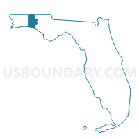
| State | Florida |
| Area (square miles) | 1.99 |
| Land Area (square miles) | 1.99 |
| Water Area (square miles) | 0.00 |
| % of Land Area | 100.00 |
| % of Water Area | 0.00 |
| Latitude of the Internal Point | 30.96117830 |
| Longtitude of the Internal Point | -86.33887370 |
Maps

Graphs
Select a template below for downloading or customizing gragh for FLOWER-Voting District, Walton County, Florida


Neighbors
Neighoring Voting District (by Name) Neighboring Voting District on the Map
- CHILDR-Voting District, Walton County, FL
- CLEAR-Voting District, Walton County, FL
- PAXTON-Voting District, Walton County, FL